This is a level 3 geometry strand activity from the Figure It Out series.
A PDF of the student activity is included.
Click on the image to enlarge it. Click again to close. Download PDF (407 KB)
follow instructions using compass directions
FIO, Level 3-4, Geometry, Around the School, page 24
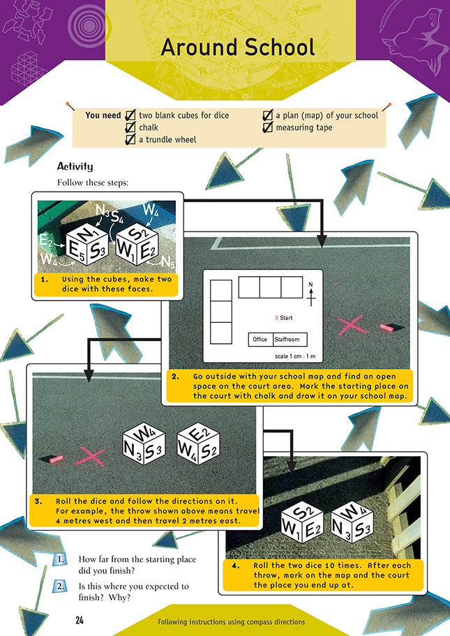
Two blank cubes for dice
A plan (map) of your school
chalk
measuring tape
trundle wheel
In this activity, the students follow directions (north, south, east, and west) on a dice and plot their path on a scale map of the school. The dice adds an element of chance as to which direction the students end up going in. The numbers and directions on the dice cancel each other out, so they will probably stay in the court area. If a school map is not available, the students could draw a scale map to plot their movements.
As an extension, the students could make another set of dice with the bearings of NE, SE, NW, and SW. They will need to make sure that the distances and directions cancel each other out.
Answers to Activity
1. Answers will vary.
2. Answers will vary, depending on what you expected. After a lot of throws, you will probably end up in about the same place as you started because all the directions and distances on the dice cancel each other out. Considering both dice together, there are three sides with north on them, which have a total of 9 m, and three sides with south on them, which have a total of 9 m, so these distances and directions will cancel each other out. The same applies for east and west distances.